
Thank you for supporting this site ❤️
Make a donation
Make a donation
Sedan topographic map
Click on the map to display elevation.
Thank you for supporting this site ❤️
Make a donation
Make a donation
About this map
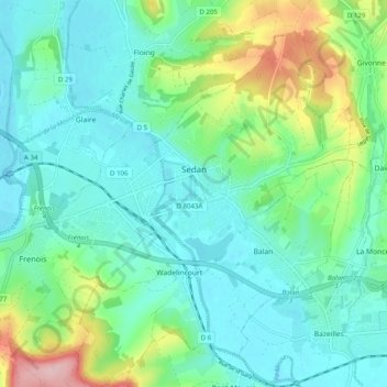
Name: Sedan topographic map, elevation, terrain.
Location: Sedan, Ardennes, Grand Est, Metropolitan France, 08200, France (49.67232 4.87718 49.72629 4.97645)
Average elevation: 192 m
Minimum elevation: 145 m
Maximum elevation: 342 m
Thank you for supporting this site ❤️
Make a donation
Make a donation