
治勒村 topographic map
Interactive map
Click on the map to display elevation.
About this map
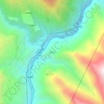
Name: 治勒村 topographic map, elevation, terrain.
Location: 治勒村, 甘洛县, 凉山彝族自治州, 四川省, 616800, 中国 (29.06388 102.80310 29.10388 102.84310)
Average elevation: 1,429 m
Minimum elevation: 885 m
Maximum elevation: 2,513 m
Other topographic maps
Click on a map to view its topography, its elevation and its terrain.