
Mazenzele topographic map
Interactive map
Click on the map to display elevation.
About this map
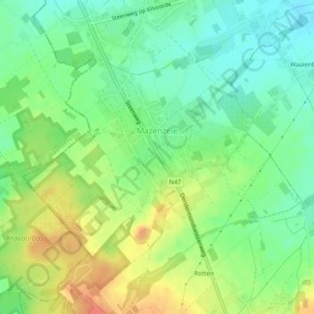
Name: Mazenzele topographic map, elevation, terrain.
Location: Mazenzele, Opwijk, Hal-Vilvorde, Brabant flamand, Belgique (50.93202 4.15345 50.94919 4.18496)
Average elevation: 50 m
Minimum elevation: 28 m
Maximum elevation: 81 m