
Portola Springs topographic map
Interactive map
Click on the map to display elevation.
About this map
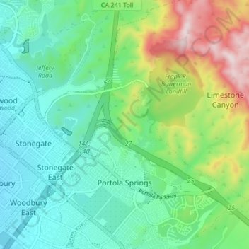
Name: Portola Springs topographic map, elevation, terrain.
Average elevation: 204 m
Minimum elevation: 73 m
Maximum elevation: 533 m
Other topographic maps
Click on a map to view its topography, its elevation and its terrain.
Orchard Hills
United States > California > Orange County > Irvine
Orchard Hills, Irvine, Orange County, California, United States
Average elevation: 184 m
Irvine
United States > California > Orange County > Irvine
Irvine, Orange County, California, 92614, United States
Average elevation: 112 m