
Thank you for supporting this site ❤️
Make a donation
Make a donation
Baramadero Chico topographic map
Click on the map to display elevation.
Thank you for supporting this site ❤️
Make a donation
Make a donation
About this map
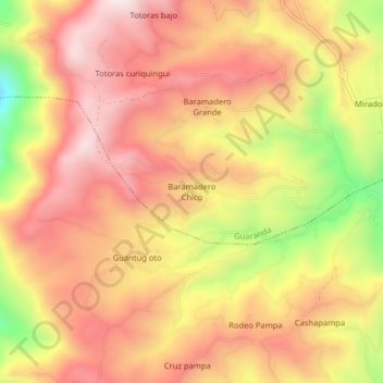
Name: Baramadero Chico topographic map, elevation, terrain.
Location: Baramadero Chico, Guaranda, Bolívar, Ecuador (-1.57889 -79.06999 -1.53889 -79.02999)
Average elevation: 3,118 m
Minimum elevation: 2,710 m
Maximum elevation: 3,364 m
Thank you for supporting this site ❤️
Make a donation
Make a donation
Other topographic maps
Click on a map to view its topography, its elevation and its terrain.