
Lalla Khedidja topographic map
Interactive map
Click on the map to display elevation.
About this map
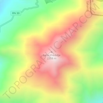
Name: Lalla Khedidja topographic map, elevation, terrain.
Location: Lalla Khedidja, Saharidj, Daïra M'Chedallah, Bouira, Algérie (36.44904 4.22799 36.44914 4.22809)
Average elevation: 1,757 m
Minimum elevation: 1,222 m
Maximum elevation: 2,288 m
Other topographic maps
Click on a map to view its topography, its elevation and its terrain.
Atlas Tellien
Algérie > Bouira > Daïra M'Chedallah > Saharidj
Atlas Tellien, Saharidj, Daïra M'Chedallah, Bouira, Algérie
Average elevation: 1,665 m