
Sana'a topographic map
Interactive map
Click on the map to display elevation.
Sana'a
At an elevation of 2,300 metres (7,500 ft), Sanaa is one of the highest capital cities in the world and is next to the Sarawat Mountains of Jabal An-Nabi Shu'ayb and Jabal Tiyal, considered to be the highest mountains in the country and amongst the highest in the region. Sanaa has a population of approximately 3,937,500 (2012), making it Yemen's largest city. As of 2020, the greater Sanaa urban area makes up about 10% of Yemen's total population.
About this map
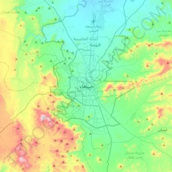
Name: Sana'a topographic map, elevation, terrain.
Location: Sana'a, At Tahrir District, Amanat Al Asimah, Yemen (15.19386 44.04588 15.51386 44.36588)
Average elevation: 2,443 m
Minimum elevation: 2,172 m
Maximum elevation: 3,193 m