
Малахов курган topographic map
Interactive map
Click on the map to display elevation.
About this map
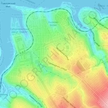
Name: Малахов курган topographic map, elevation, terrain.
Location: Малахов курган, Нахимовский округ, Украина (44.60209 33.54556 44.60696 33.55055)
Average elevation: 49 m
Minimum elevation: -4 m
Maximum elevation: 140 m