
Thank you for supporting this site ❤️
Make a donation
Make a donation
Lajas topographic map
Click on the map to display elevation.
Thank you for supporting this site ❤️
Make a donation
Make a donation
About this map
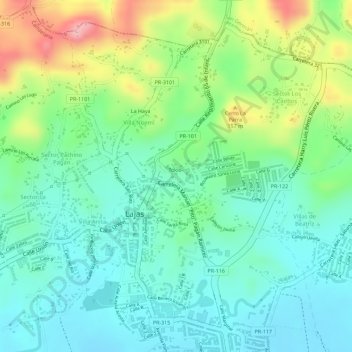
Name: Lajas topographic map, elevation, terrain.
Location: Lajas, Puerto Rico, United States (18.04148 -67.06558 18.06514 -67.04199)
Average elevation: 79 m
Minimum elevation: 28 m
Maximum elevation: 180 m
Thank you for supporting this site ❤️
Make a donation
Make a donation