
Serra de Opa topographic map
Interactive map
Click on the map to display elevation.
About this map
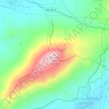
Name: Serra de Opa topographic map, elevation, terrain.
Location: Serra de Opa, Penamacor, Castelo Branco, 6090-723, Portugal (40.28597 -7.21265 40.28607 -7.21255)
Average elevation: 624 m
Minimum elevation: 504 m
Maximum elevation: 862 m
Other topographic maps
Click on a map to view its topography, its elevation and its terrain.
Aranhas
Portugal > Castelo Branco > Penamacor
Aranhas, Penamacor, Castelo Branco, Portugal
Average elevation: 482 m