
Lavandeira topographic map
Interactive map
Click on the map to display elevation.
About this map
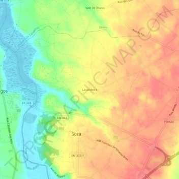
Name: Lavandeira topographic map, elevation, terrain.
Location: Lavandeira, Sosa, Vagos, Aveiro, 3840-420, Portugal (40.53417 -8.67498 40.57417 -8.63498)
Average elevation: 40 m
Minimum elevation: -2 m
Maximum elevation: 71 m