
Egginton CP topographic map
Interactive map
Click on the map to display elevation.
About this map
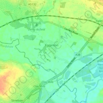
Name: Egginton CP topographic map, elevation, terrain.
Average elevation: 51 m
Minimum elevation: 38 m
Maximum elevation: 71 m
Other topographic maps
Click on a map to view its topography, its elevation and its terrain.
Weston-on-Trent
United Kingdom > England > Derbyshire > South Derbyshire
Weston-on-Trent, South Derbyshire, Derbyshire, England, DE72 2DJ, United Kingdom
Average elevation: 52 m
Netherseal
United Kingdom > England > Derbyshire > South Derbyshire
Netherseal, South Derbyshire, Derbyshire, England, United Kingdom
Average elevation: 89 m
Findern
United Kingdom > England > Derbyshire > South Derbyshire > Findern
Findern, South Derbyshire, Derbyshire, East Midlands, England, DE65 6AP, United Kingdom
Average elevation: 56 m