
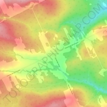
Val-d'Espoir topographic map
Interactive map
Click on the map to display elevation.
About this map
Name: Val-d'Espoir topographic map, elevation, terrain.
Average elevation: 135 m
Minimum elevation: 56 m
Maximum elevation: 215 m
Other topographic maps
Click on a map to view its topography, its elevation and its terrain.
Barachois
Canada > Québec > Le Rocher-Percé > Percé
Barachois, Percé, Le Rocher-Percé, Gaspésie–Îles-de-la-Madeleine, Québec, Canada
Average elevation: 28 m
Mont Sainte-Anne
Canada > Québec > Le Rocher-Percé > Percé
Mont Sainte-Anne, Percé, Le Rocher-Percé, Gaspésie–Îles-de-la-Madeleine, Québec, G0C 2L0, Canada
Average elevation: 162 m
Rivière Malbaie
Canada > Québec > Le Rocher-Percé > Percé
Rivière Malbaie, Percé, Le Rocher-Percé, Gaspésie–Îles-de-la-Madeleine, Québec, Canada
Average elevation: 229 m