
Residence Foch topographic map
Interactive map
Click on the map to display elevation.
About this map
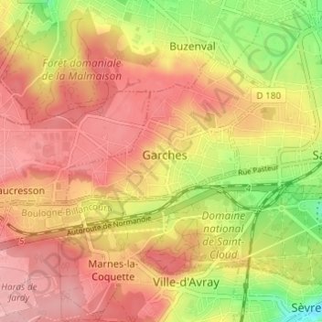
Name: Residence Foch topographic map, elevation, terrain.
Average elevation: 129 m
Minimum elevation: 47 m
Maximum elevation: 182 m
Other topographic maps
Click on a map to view its topography, its elevation and its terrain.
92380
France > Île-de-France > Hauts-de-Seine > Garches > Residence Foch
92380, Residence Foch, Garches, Nanterre, Hauts-de-Seine, Île-de-France, France métropolitaine, France
Average elevation: 127 m
Résidence de la Lisière du Golf
France > Île-de-France > Hauts-de-Seine > Garches
Résidence de la Lisière du Golf, Garches, Nanterre, Hauts-de-Seine, Île-de-France, France métropolitaine, 92380, France
Average elevation: 106 m