
Ridgeway topographic map
Interactive map
Click on the map to display elevation.
About this map
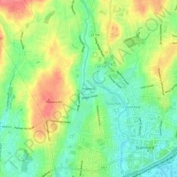
Name: Ridgeway topographic map, elevation, terrain.
Average elevation: 31 m
Minimum elevation: 1 m
Maximum elevation: 70 m
Other topographic maps
Click on a map to view its topography, its elevation and its terrain.
Northfield
United States > Connecticut > Fairfield County > Stamford
Northfield, Stamford, Fairfield County, Connecticut, 06901, United States
Average elevation: 25 m
Palmers Hill
United States > Connecticut > Fairfield County > Stamford > Palmers Hill
Palmers Hill, Stamford, Fairfield County, Connecticut, 06904, United States
Average elevation: 31 m