Geolocate

东坝乡 topographic map

Interactive map

Click on the map to display elevation.

About this map

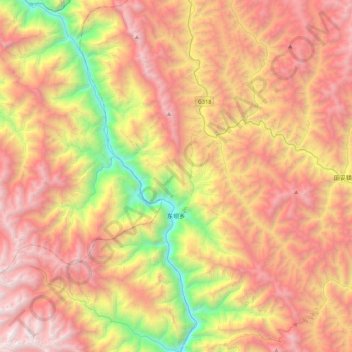
Name: 东坝乡 topographic map, elevation, terrain.

Location: 东坝乡, 左贡县, 昌都市, 西藏自治区, 中国 (29.70980 97.30442 30.08807 97.57490)

Average elevation: 4,267 m

Minimum elevation: 2,599 m

Maximum elevation: 5,783 m

Other topographic maps

Click on a map to view its topography, its elevation and its terrain.

扎玉镇

中国 > 西藏自治区 > 左贡县

扎玉镇, 左贡县, 昌都市, 西藏自治区, 中国

Average elevation: 4,230 m

碧土乡

中国 > 西藏自治区 > 左贡县

碧土乡, 左贡县, 昌都市, 西藏自治区, 中国

Average elevation: 3,940 m

河流

中国 > 西藏自治区 > 左贡县

河流, 左贡县, 昌都市, 西藏自治区, 中国

Average elevation: 3,488 m

乌雅卓热

中国 > 西藏自治区 > 左贡县 > 旺达镇 > 乌雅卓热

乌雅卓热, 旺达镇, 左贡县, 昌都市, 西藏自治区, 中国

Average elevation: 4,457 m

玉曲

中国 > 西藏自治区 > 左贡县

玉曲, 左贡县, 昌都市, 西藏自治区, 中国

Average elevation: 4,470 m