
Thank you for supporting this site ❤️
Make a donation
Make a donation
Budingen topographic map
Click on the map to display elevation.
Thank you for supporting this site ❤️
Make a donation
Make a donation
About this map
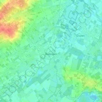
Name: Budingen topographic map, elevation, terrain.
Location: Budingen, Léau, Louvain, Brabant flamand, Flandre, Belgique (50.84612 5.04340 50.88467 5.12009)
Average elevation: 32 m
Minimum elevation: 20 m
Maximum elevation: 68 m
Thank you for supporting this site ❤️
Make a donation
Make a donation
Other topographic maps
Click on a map to view its topography, its elevation and its terrain.