
绿茵湖街道 topographic map
Interactive map
Click on the map to display elevation.
About this map
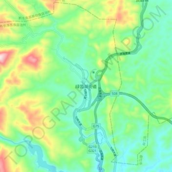
Name: 绿茵湖街道 topographic map, elevation, terrain.
Location: 绿茵湖街道, 都匀市, 黔南布依族苗族自治州, 贵州省, 558000, 中国 (26.34425 107.46182 26.42425 107.54182)
Average elevation: 970 m
Minimum elevation: 811 m
Maximum elevation: 1,339 m
Other topographic maps
Click on a map to view its topography, its elevation and its terrain.