
Thank you for supporting this site ❤️
Make a donation
Make a donation
Le Plate topographic map
Click on the map to display elevation.
Thank you for supporting this site ❤️
Make a donation
Make a donation
About this map
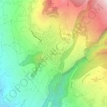
Name: Le Plate topographic map, elevation, terrain.
Location: Le Plate, Saint-Leu, Saint-Paul, La Réunion, France (-21.21628 55.32696 -21.19517 55.33929)
Average elevation: 721 m
Minimum elevation: 410 m
Maximum elevation: 1,113 m
Thank you for supporting this site ❤️
Make a donation
Make a donation
Other topographic maps
Click on a map to view its topography, its elevation and its terrain.
Thank you for supporting this site ❤️
Make a donation
Make a donation
Thank you for supporting this site ❤️
Make a donation
Make a donation
Thank you for supporting this site ❤️
Make a donation
Make a donation