
Midway topographic map
Interactive map
Click on the map to display elevation.
About this map
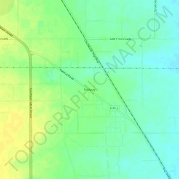
Name: Midway topographic map, elevation, terrain.
Location: Midway, Chaves County, New Mexico, United States (33.27482 -104.47052 33.31482 -104.43052)
Average elevation: 1,089 m
Minimum elevation: 1,079 m
Maximum elevation: 1,101 m
Other topographic maps
Click on a map to view its topography, its elevation and its terrain.
Roswell
United States > New Mexico > Chaves County > Roswell
Roswell, Chaves County, New Mexico, 88201, United States
Average elevation: 1,126 m
Roswell
United States > New Mexico > Chaves County
Roswell, Chaves County, New Mexico, United States
Average elevation: 1,106 m