
Boghall topographic map
Interactive map
Click on the map to display elevation.
About this map
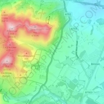
Name: Boghall topographic map, elevation, terrain.
Location: Boghall, Midlothian, Scotland, EH26 0PE, United Kingdom (55.85337 -3.22962 55.89337 -3.18962)
Average elevation: 235 m
Minimum elevation: 124 m
Maximum elevation: 490 m