
和平县 topographic map
Interactive map
Click on the map to display elevation.
About this map
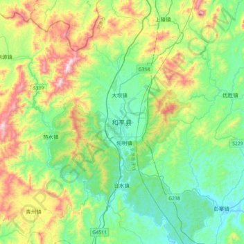
Name: 和平县 topographic map, elevation, terrain.
Location: 和平县, 河源市, 广东省, 中国 (24.31243 114.77074 24.63243 115.09074)
Average elevation: 371 m
Minimum elevation: 96 m
Maximum elevation: 1,037 m