
Poelberg topographic map
Interactive map
Click on the map to display elevation.
About this map
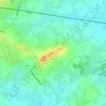
Name: Poelberg topographic map, elevation, terrain.
Location: Poelberg, Tielt, West-Vlaanderen, Vlaanderen, 8700, België (50.98044 3.36045 50.98054 3.36055)
Average elevation: 20 m
Minimum elevation: 10 m
Maximum elevation: 43 m
Other topographic maps
Click on a map to view its topography, its elevation and its terrain.
Hulstplein
België > Vlaanderen > Tielt
Hulstplein, Tielt, West-Vlaanderen, Vlaanderen, 8700, België
Average elevation: 35 m