
Port Townsend topographic map
Interactive map
Click on the map to display elevation.
About this map
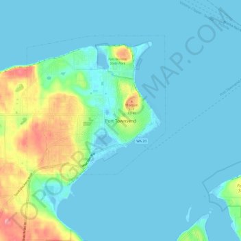
Name: Port Townsend topographic map, elevation, terrain.
Location: Port Townsend, Jefferson County, Washington, United States (48.07797 -122.80954 48.15797 -122.72954)
Average elevation: 18 m
Minimum elevation: -7 m
Maximum elevation: 106 m