
Howden topographic map
Interactive map
Click on the map to display elevation.
About this map
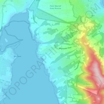
Name: Howden topographic map, elevation, terrain.
Location: Howden, Tasmania, 7054, Australia (-43.04501 147.27813 -43.00501 147.31813)
Average elevation: 58 m
Minimum elevation: 0 m
Maximum elevation: 295 m