
黟县 topographic map
Interactive map
Click on the map to display elevation.
About this map
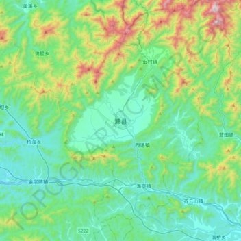
Name: 黟县 topographic map, elevation, terrain.
Location: 黟县, 黄山市, 安徽省, 中国 (29.76660 117.77460 30.08660 118.09460)
Average elevation: 397 m
Minimum elevation: 124 m
Maximum elevation: 1,392 m