
Славянск topographic map
Interactive map
Click on the map to display elevation.
About this map
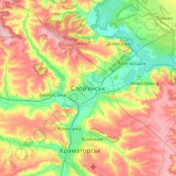
Name: Славянск topographic map, elevation, terrain.
Average elevation: 131 m
Minimum elevation: 52 m
Maximum elevation: 245 m
Other topographic maps
Click on a map to view its topography, its elevation and its terrain.
Красное озеро
Украина > Донецкая область > Славянск
Красное озеро, Червоне Містечко, Славянский курорт, Славянск, Славянская городская община, Краматорский район, Донецкая область, Украина
Average elevation: 68 m