
白朗县 topographic map
Interactive map
Click on the map to display elevation.
About this map
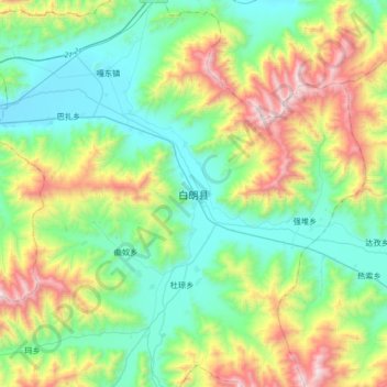
Name: 白朗县 topographic map, elevation, terrain.
Location: 白朗县, 洛江镇, 白朗县, 日喀则市, 西藏自治区, 中国 (28.95158 89.09963 29.27158 89.41963)
Average elevation: 4,334 m
Minimum elevation: 3,860 m
Maximum elevation: 5,495 m