
Chester topographic map
Interactive map
Click on the map to display elevation.
About this map
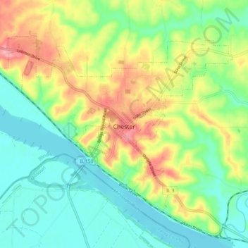
Name: Chester topographic map, elevation, terrain.
Location: Chester, Randolph County, Illinois, United States (37.88875 -89.87316 37.93992 -89.78236)
Average elevation: 145 m
Minimum elevation: 102 m
Maximum elevation: 220 m
Other topographic maps
Click on a map to view its topography, its elevation and its terrain.
Chester
United States > Illinois > Randolph County > Chester
Chester, Randolph County, Illinois, 62233, United States
Average elevation: 143 m