
Topchanchi topographic map
Interactive map
Click on the map to display elevation.
About this map
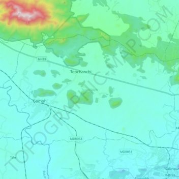
Name: Topchanchi topographic map, elevation, terrain.
Location: Topchanchi, Dhanbad, Jharkhand, India (23.82795 86.11045 23.94186 86.31159)
Average elevation: 311 m
Minimum elevation: 165 m
Maximum elevation: 1,351 m
Other topographic maps
Click on a map to view its topography, its elevation and its terrain.
Baghmara-Cum-Katras
Baghmara-Cum-Katras, Dhanbad, Jharkhand, India
Average elevation: 227 m