
Espot topographic map
Interactive map
Click on the map to display elevation.
About this map
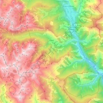
Name: Espot topographic map, elevation, terrain.
Location: Espot, Pallars Sobirà, Lleida, Catalonia, Spain (42.50877 0.93720 42.61015 1.14621)
Average elevation: 1,867 m
Minimum elevation: 848 m
Maximum elevation: 2,926 m