
Palo Pinto County topographic map
Interactive map
Click on the map to display elevation.
About this map
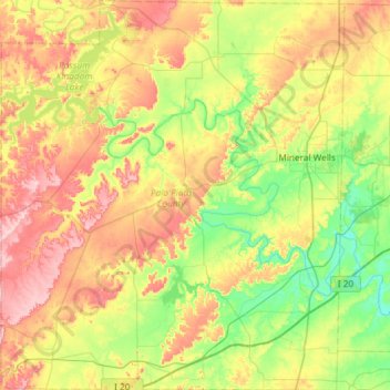
Name: Palo Pinto County topographic map, elevation, terrain.
Location: Palo Pinto County, Texas, USA (32.51158 -98.57616 33.00781 -98.05593)
Average elevation: 317 m
Minimum elevation: 221 m
Maximum elevation: 468 m
Other topographic maps
Click on a map to view its topography, its elevation and its terrain.