
Thank you for supporting this site ❤️
Make a donation
Make a donation
Denton County topographic map
Click on the map to display elevation.
Thank you for supporting this site ❤️
Make a donation
Make a donation
About this map
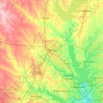
Name: Denton County topographic map, elevation, terrain.
Location: Denton County, Texas, United States (32.98744 -97.39848 33.43043 -96.83410)
Average elevation: 202 m
Minimum elevation: 130 m
Maximum elevation: 310 m
Thank you for supporting this site ❤️
Make a donation
Make a donation