
Thank you for supporting this site ❤️
Make a donation
Make a donation
Taraz city administration topographic map
Click on the map to display elevation.
Thank you for supporting this site ❤️
Make a donation
Make a donation
About this map
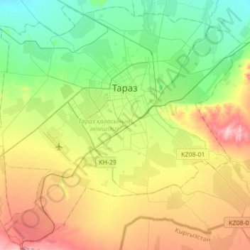
Name: Taraz city administration topographic map, elevation, terrain.
Location: Taraz city administration, Jambyl Region, Kazakhstan (42.77543 71.23113 42.96781 71.50466)
Average elevation: 649 m
Minimum elevation: 557 m
Maximum elevation: 807 m
Thank you for supporting this site ❤️
Make a donation
Make a donation
Other topographic maps
Click on a map to view its topography, its elevation and its terrain.