
Thank you for supporting this site ❤️
Make a donation
Make a donation
Thamari topographic map
Click on the map to display elevation.
Thank you for supporting this site ❤️
Make a donation
Make a donation
About this map
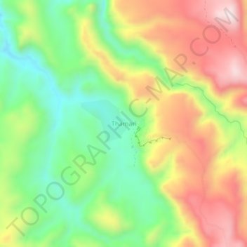
Name: Thamari topographic map, elevation, terrain.
Location: Thamari, Potosí, Provincia Tomás Frías, Potosí, Bolivia (-19.36882 -65.76083 -19.32882 -65.72083)
Average elevation: 3,532 m
Minimum elevation: 3,280 m
Maximum elevation: 3,836 m
Thank you for supporting this site ❤️
Make a donation
Make a donation
Other topographic maps
Click on a map to view its topography, its elevation and its terrain.