
Gunungwungkal topographic map
Interactive map
Click on the map to display elevation.
About this map
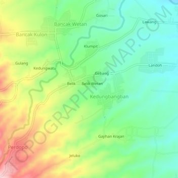
Name: Gunungwungkal topographic map, elevation, terrain.
Location: Gunungwungkal, Pati, Central Java, Indonesia (-6.59140 110.97149 -6.55140 111.01149)
Average elevation: 125 m
Minimum elevation: 37 m
Maximum elevation: 273 m