
Aïn Zouit topographic map
Interactive map
Click on the map to display elevation.
About this map
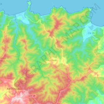
Name: Aïn Zouit topographic map, elevation, terrain.
Location: Aïn Zouit, Daïra El Hadaik, Skikda, Algérie (36.83466 6.72745 36.96426 6.88731)
Average elevation: 231 m
Minimum elevation: 0 m
Maximum elevation: 682 m
Other topographic maps
Click on a map to view its topography, its elevation and its terrain.
La Grande Plage
Algérie > Skikda > Daïra El Hadaik > Aïn Zouit
La Grande Plage, Aïn Zouit, Daïra El Hadaik, Skikda, Algérie
Average elevation: 49 m