
Glassboro topographic map
Interactive map
Click on the map to display elevation.
About this map
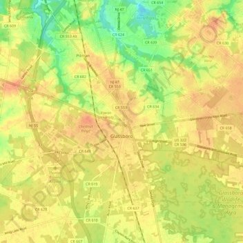
Name: Glassboro topographic map, elevation, terrain.
Location: Glassboro, Gloucester County, New Jersey, United States (39.67858 -75.16826 39.73739 -75.05472)
Average elevation: 40 m
Minimum elevation: 14 m
Maximum elevation: 55 m