
Thank you for supporting this site ❤️
Make a donation
Make a donation
McKinney topographic map
Click on the map to display elevation.
Thank you for supporting this site ❤️
Make a donation
Make a donation
About this map
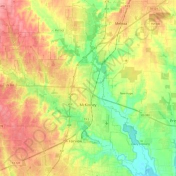
Name: McKinney topographic map, elevation, terrain.
Location: McKinney, Collin County, Texas, United States (33.12529 -96.76790 33.30609 -96.53851)
Average elevation: 193 m
Minimum elevation: 147 m
Maximum elevation: 242 m
Thank you for supporting this site ❤️
Make a donation
Make a donation
Other topographic maps
Click on a map to view its topography, its elevation and its terrain.