
Heide-Heuvel topographic map
Interactive map
Click on the map to display elevation.
About this map
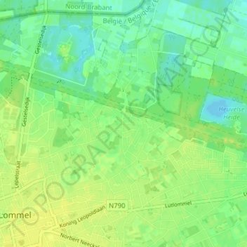
Name: Heide-Heuvel topographic map, elevation, terrain.
Location: Heide-Heuvel, Lommel, Maaseik, Limburg, Vlaanderen, 3920, België (51.22536 5.31588 51.26536 5.35588)
Average elevation: 44 m
Minimum elevation: 35 m
Maximum elevation: 51 m
Other topographic maps
Click on a map to view its topography, its elevation and its terrain.
Lommelse Sahara
België > Limburg > Maaseik > Lommel
Lommelse Sahara, Lommel, Maaseik, Limburg, Vlaanderen, 3920, België
Average elevation: 46 m
Blauwe Kei
België > Limburg > Maaseik > Lommel
Blauwe Kei, Lommel, Maaseik, Limburg, Vlaanderen, 3920, België
Average elevation: 39 m
Gelderhorsten
België > Limburg > Maaseik > Lommel > Gelderhorsten
Gelderhorsten, Lommel, Maaseik, Limburg, Vlaanderen, 3920, België
Average elevation: 45 m