
Wittenberg topographic map
Interactive map
Click on the map to display elevation.
About this map
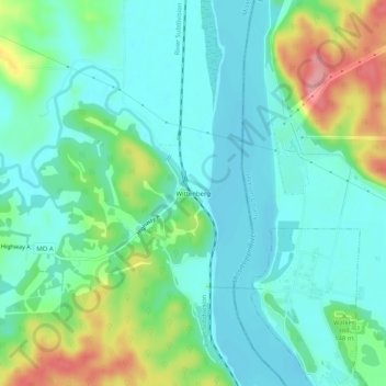
Name: Wittenberg topographic map, elevation, terrain.
Location: Wittenberg, Perry County, Missouri, 62942, United States (37.63189 -89.54289 37.67189 -89.50289)
Average elevation: 130 m
Minimum elevation: 99 m
Maximum elevation: 211 m
Other topographic maps
Click on a map to view its topography, its elevation and its terrain.
Perryville
United States > Missouri > Perry County
Perryville, Perry County, Missouri, 63775, United States
Average elevation: 171 m
Perryville
United States > Missouri > Perry County > Perryville > Perryville
Perryville, Perry County, Missouri, 63775, United States
Average elevation: 170 m