
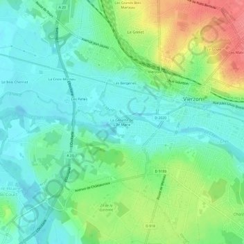
La Genette de L'Île Marie topographic map
Interactive map
Click on the map to display elevation.
About this map
Name: La Genette de L'Île Marie topographic map, elevation, terrain.
Average elevation: 116 m
Minimum elevation: 93 m
Maximum elevation: 164 m
Other topographic maps
Click on a map to view its topography, its elevation and its terrain.
Les Mabilats
France > Centre-Val de Loire > Cher > Vierzon
Les Mabilats, Vierzon, Cher, Centre-Val de Loire, France métropolitaine, 18100, France
Average elevation: 138 m
Les Bergeries
France > Centre-Val de Loire > Cher > Vierzon
Les Bergeries, Vierzon, Cher, Centre-Val de Loire, France métropolitaine, 18100, France
Average elevation: 119 m
Étang des Forges
France > Centre-Val de Loire > Cher > Vierzon
Étang des Forges, Vierzon, Cher, Centre-Val de Loire, France métropolitaine, 18100, France
Average elevation: 117 m