
Manebach topographic map
Interactive map
Click on the map to display elevation.
About this map
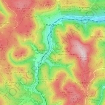
Name: Manebach topographic map, elevation, terrain.
Location: Manebach, Ilmenau, Ilm-Kreis, Thüringen, Duitsland (50.64389 10.81823 50.68970 10.86796)
Average elevation: 676 m
Minimum elevation: 493 m
Maximum elevation: 855 m