
Cairo topographic map
Interactive map
Click on the map to display elevation.
About this map
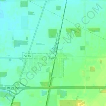
Name: Cairo topographic map, elevation, terrain.
Location: Cairo, Allen County, Ohio, 45820, United States (40.82698 -84.09318 40.83927 -84.07743)
Average elevation: 249 m
Minimum elevation: 241 m
Maximum elevation: 261 m
The elevation of the land area of Cairo (ranges from about 812' at the west end to 842' at the east end of the village above sea level) is benchmarked at 815 feet (248 m) above sea level, generally flat and moderately wooded. The nearest stream with year-round flow is Rattlesnake Creek, which flows from south of the village and passes just to the west of the village. Water flow in the village is generally from the south and east to the north and west.
Other topographic maps
Click on a map to view its topography, its elevation and its terrain.
Lima
United States > Ohio > Allen County
Lima, Allen County, Ohio, 45804, United States
Average elevation: 267 m
Spencerville
United States > Ohio > Allen County
Spencerville, Allen County, Ohio, 45887, United States
Average elevation: 254 m
Bluffton
United States > Ohio > Allen County
Bluffton, Allen County, Ohio, 45817, United States
Average elevation: 255 m
Delphos
United States > Ohio > Allen County
Delphos, Allen County, Ohio, 45833, United States
Average elevation: 236 m
Maysville
United States > Ohio > Allen County
Maysville, Jackson Township, Allen County, Ohio, United States
Average elevation: 307 m
Kemp
United States > Ohio > Allen County
Kemp, Allen County, Ohio, United States
Average elevation: 256 m
Landeck
United States > Ohio > Allen County
Landeck, Allen County, Ohio, United States
Average elevation: 242 m
Scotts Crossing
United States > Ohio > Allen County
Scotts Crossing, Allen County, Ohio, United States
Average elevation: 239 m
Hume
United States > Ohio > Allen County
Hume, Allen County, Ohio, United States
Average elevation: 260 m
Gomer
United States > Ohio > Allen County
Gomer, Allen County, Ohio, 45809, United States
Average elevation: 237 m
West Newton
United States > Ohio > Allen County
West Newton, Auglaize Township, Allen County, Ohio, United States
Average elevation: 316 m
Southworth
United States > Ohio > Allen County
Southworth, Allen County, Ohio, United States
Average elevation: 247 m
South Warsaw
United States > Ohio > Allen County
South Warsaw, Perry Township, Allen County, Ohio, United States
Average elevation: 283 m
Rockport
United States > Ohio > Allen County
Rockport, Monroe Township, Allen County, Ohio, 45830, United States
Average elevation: 248 m
Conant
United States > Ohio > Allen County
Conant, Allen County, Ohio, United States
Average elevation: 251 m
Allentown
United States > Ohio > Allen County > Lima
Allentown, Lima, Allen County, Ohio, 45805, United States
Average elevation: 250 m
Westminster
United States > Ohio > Allen County
Westminster, Auglaize Township, Allen County, Ohio, United States
Average elevation: 294 m
Elida
United States > Ohio > Allen County
Elida, Allen County, Ohio, United States
Average elevation: 244 m
Beaverdam
United States > Ohio > Allen County
Beaverdam, Allen County, Ohio, 45808, United States
Average elevation: 264 m
Fort Shawnee
United States > Ohio > Allen County
Fort Shawnee, Allen County, Ohio, 45806, United States
Average elevation: 268 m
Lafayette
United States > Ohio > Allen County
Lafayette, Allen County, Ohio, 45854, United States
Average elevation: 286 m
Lima
United States > Ohio > Allen County
Lima, Allen County, Ohio, 45804, United States
Average elevation: 267 m
Harrod
United States > Ohio > Allen County
Harrod, Allen County, Ohio, United States
Average elevation: 305 m