
Thank you for supporting this site ❤️
Make a donation
Make a donation
Karimpur topographic map
Click on the map to display elevation.
Thank you for supporting this site ❤️
Make a donation
Make a donation
Karimpur
Karimpur is located at 23°58′N 88°37′E / 23.97°N 88.62°E / 23.97; 88.62. It has an average elevation of 15 metres (49 ft). It is 183 km (114 mi) from Kolkata and is located at the bank of the River Jalangi.
Thank you for supporting this site ❤️
Make a donation
Make a donation
About this map
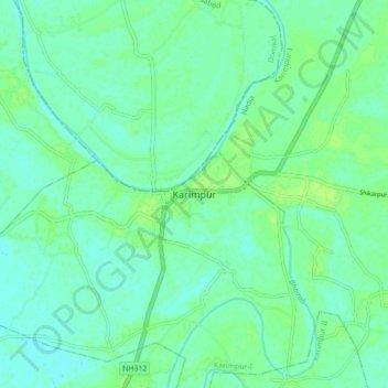
Name: Karimpur topographic map, elevation, terrain.
Average elevation: 18 m
Minimum elevation: 13 m
Maximum elevation: 24 m
Thank you for supporting this site ❤️
Make a donation
Make a donation