
Cleveland topographic map
Interactive map
Click on the map to display elevation.
About this map
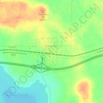
Name: Cleveland topographic map, elevation, terrain.
Location: Cleveland, Stutsman County, North Dakota, United States (46.88640 -99.12639 46.89392 -99.11582)
Average elevation: 565 m
Minimum elevation: 540 m
Maximum elevation: 594 m
Other topographic maps
Click on a map to view its topography, its elevation and its terrain.
Jamestown
United States > North Dakota > Stutsman County
Jamestown, Stutsman County, North Dakota, United States
Average elevation: 451 m