
Neuville-lès-Lœuilly topographic map
Interactive map
Click on the map to display elevation.
About this map
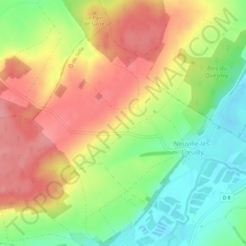
Name: Neuville-lès-Lœuilly topographic map, elevation, terrain.
Average elevation: 91 m
Minimum elevation: 40 m
Maximum elevation: 139 m
Other topographic maps
Click on a map to view its topography, its elevation and its terrain.
Coulée Verte
France > Hauts-de-France > Somme > Ô-de-Selle
Coulée Verte, Tilloy-lès-Conty, Ô-de-Selle, Amiens, Somme, Hauts-de-France, France métropolitaine, 80160, France
Average elevation: 74 m