
Grimbergen topographic map
Interactive map
Click on the map to display elevation.
About this map
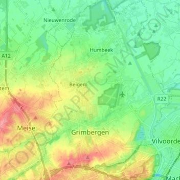
Name: Grimbergen topographic map, elevation, terrain.
Location: Grimbergen, Hal-Vilvorde, Brabant flamand, Flandre, Belgique (50.91213 4.33969 50.98831 4.42640)
Average elevation: 26 m
Minimum elevation: -1 m
Maximum elevation: 70 m