
Batu 18 Hulu Langat topographic map
Interactive map
Click on the map to display elevation.
About this map
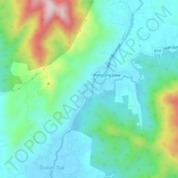
Name: Batu 18 Hulu Langat topographic map, elevation, terrain.
Location: Batu 18 Hulu Langat, Selangor, Malaysia (3.14402 101.82750 3.18402 101.86750)
Average elevation: 181 m
Minimum elevation: 56 m
Maximum elevation: 556 m