
Norderstapel topographic map
Interactive map
Click on the map to display elevation.
About this map
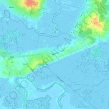
Name: Norderstapel topographic map, elevation, terrain.
Average elevation: 4 m
Minimum elevation: -4 m
Maximum elevation: 48 m
Other topographic maps
Click on a map to view its topography, its elevation and its terrain.
Süderstapel
Deutschland > Schleswig-Holstein > Schleswig-Flensburg > Stapel
Süderstapel, Stapel, Kropp-Stapelholm, Schleswig-Flensburg, Schleswig-Holstein, Deutschland
Average elevation: 2 m